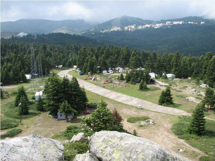
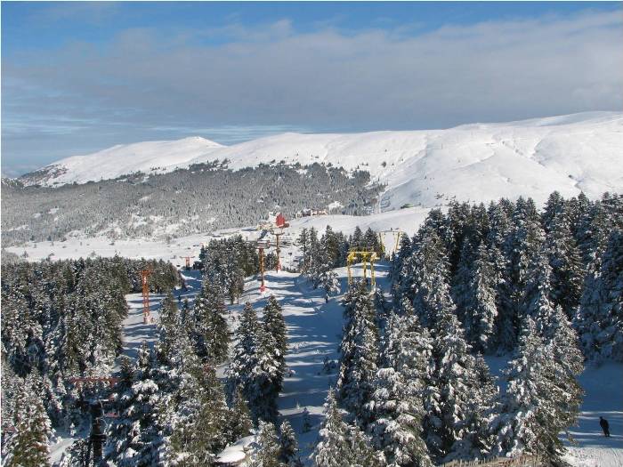
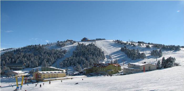

The Uludağ Mountain, 2 thousand 543 meters high, is the most popular winter sports center of our country. Uludağ was declared a National Park in 1961 with its unique beauty, richness in flora and fauna; winter tourism, as well as in the summer months, camping, trekking and day picnic activities by providing the opportunity to attract domestic and foreign tourists. With these features, Uludag has a nature that serves four seasons. The highest point of the national park is the Uludağ Tepe (2543 m). Other elevations are Zirvetepe (2468m), Kuşaklıkaya (2232m), Çobankaya (1750m), Bakacak Tepe (1743m). There are arcs like Salıalan (1621 m), Kirazlıyayla (1505 m), Kadıyayla (1235 m), and the branches of Nilüfer Stream, Dombay Çukuru Dere, Softadere, Derinçay Dere. Since 1933, Uludağ has been a skiing center. Uludağ, Turkey's most important winter sports and skiing center, has 178 snow-covered days. To this day, the thickness of snow has been measured up to 435 cm maximum. The world famous Uludağ ski slopes are built on the top of Fatintepe and Kuşakkaya hills. The Uludağ Ski Center is divided into two Development zone. In the first development zone, there are a total of 36 accommodation and rest facilities including 17 public and 19 private facilities. The total bed capacity is around 10,000.
In the second Development Zone, declared to be a Tourism center in 1986, there are 4 hotels. The Uludağ ski resort has suitable geographical conditions in terms of Alpine and Northern discipline and "Tour lane" and "Helicopter skiing" pratice. Other than skiing, snowboarding, big foot, ice-skating, snowmobile activities are other alternatives for visitors. There are 15 mechanic facilities, 8 ski lifts and 7 telescopes in the Hotels area. 13 different tracks are still in service. The ski resort is 36 km away from Bursa and 150 km away from Istanbul. One of the extraordinary beauty that Uludag has to offer is the cable car access. There are a total of four lines services between Bursa-Kadıyayla (1235 m) and Kadıyayla-Sarıalan (1621 m). A cabin can carry up to 30 people. It takes 20 minutes to get to Kadyyayla from the Teleferik neighborhood. In Kadıyayla, you can change the line and ride the one going to Sarıalan. The journey takes about 25 minutes. It is possible to reach the Hotels area from Sarıalan by minibus for 7 km. Also during the summer; There is an important camp site, the Çobankaya (1750 m) site, that you can reach by Gondola lift from Sarıalan. In the National Park, wild boars, fox, jackals, wolves, badgers, wild cats and whistle bears, moles, squirrels, sorex, weasels and few moon bear are living there. There is also a deer farm in Yeşiltarla. The bearded vulture (Gypaetus Barbatus) is an endemic species living in Uludağ. Apollo butterfly is the largest butterfly species living in Turkey, it is one of the most spectacular display of color living in Uludag. In July and August, the Apollo Butterfly, that are dancing through the meadows of Uludağ full of flowers, is a species that can still live even at an altitude of 6,000 m. 71% of the Uludağ National Park, which was declared as a national park in 1961 and covering 12,762 hectares, is a forest for 17%, has pasture and rocky for 28%, 0,4% open field, 0,1% of wetland, 0,5% is a settlement area. The first traces of the Ice age in Turkey is seen in Uludag. The slopes facing the north of Uludağ have glacial- shaped formations and interesting-looking rock masses. Forms such as Yılanlıkaya, Cennetkaya, Çobankaya are the most typical examples of these. There are glacier lakes in the higher parts of the National Park. Source: Bursa Provincial Directorate of Culture and Tourism